FAFE
« Look, my dear, this good land of Fafe is like this: bread, bread, cheese and cheese – Portuguese by law, hospitable, frank to the point of rudeness and also capable of putting a good club of fence, their justice, where the king don’t post your own.
And it is that the sword goes to the donkey, and nothing for that to contradict the haughty Fafe. But it’s sympathetic, isn’t it?
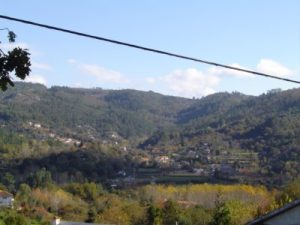
I, myself, when returning from Basto, on one of the excursions I made through the province, I arrived at the top of Gandarela and saw the wide basin in bloom with emeralds, on which most of the county is located, a landscape where the light laughs and the water plays, I had the understanding of this masculine and healthy joy, encountering in the extensive valley and in the rough mountains with the aspect of nature, which is at the same time uberrine and joyful, strong and expansive. There you have the man explained through the middle.” [1]
Fafe is the simultaneous designation of two distinct realities: the only urban parish and administrative seat of the municipality and that of the municipality.
It is located in the geographic Minho. The Minho of economic, social and human contrasts: The Coast, the Alto Minho, and the Minho Interior.
Fafe, within this northern region of the country, belongs to the Minho do Interior; the Minho do Alto Ave and the foothills of Marão, Cabreira and Gerês, where small valleys run by numerous streams from the mountain range that surrounds the county and fill most of its territory which the Romanization called “Mons Longus “, where its former municipality designation is based – Montelongo.
It is located at 41 0 27.6 ‘latitude and 0 0 58.2′ E of the Lisbon meridian, with an average altitude relief of 350 meters, reaching 893 meters at the highest point.
From this region, in 1527, we have one of the first descriptive references: « This municipality of Momtelomguo has land of maintain and caise ground ? a first territory, which the municipality of Montelongo occupied, and which currently forms part of the current municipality of Fafe.
The geographic limits of the current municipality are defined, to the North by the Ave rivers and to the East by the Tâmega, which, through their deep valleys, mark the borders of this micro-region in the East-West and North-South directions, thus delimiting from the lands of Barroso and Marão. To this side of the Tâmega river is the Serra do Viso, as the limit of the territory of Fafe, as a natural extension of the plateau of “Monte Longo” and located in the municipality of Celorico de Basto.
Geographically, Fafe is already the end of the extensive and open valleys of the North Coast, which slowly adjust and reduce, progressively approaching the foothills of the mountains in the interior, announcing the beginning of the municipalities of Minho Interior.
The administrative boundaries are defined to the north by the municipalities of Póvoa de Lanhoso and Vieira do Minho; to the east, by Cabeceiras de Basto and Celorico de Basto; to the West, by the municipality of Guimarães; to the south by Felgueiras.
Leaving the county seat, go to the first two, traveling through the meandering narrow valley of Vizela and, from Travassós, along the Pequeno river, to reach the Ave basin and the Barroso lands. The municipalities of Basto can be reached by crossing the mountains of Moreira or Lameira.
To the municipalities of Guimarães and Felgueiras, you walk towards the South and Southwest, seeming easier and closer.
The hills seem to open the way, crouching and opening up to facilitate passages, where everything seems more open, but also fuller, richer and greener, in a local geomorphological framework that, over millennia, has presented very slow and undetectable.
These elevations, without evidencing the characteristics of the Mountains, present extensions on the slopes that elongate in a progressive decrease in altitude oriented to the South and West, where the neighboring municipalities of Felgueiras and Guimarães are located.
In the North, the altitude of the Monte Longo plateau, which surrounds the municipality, is accentuated, where the Vizela, Ferro, Bugio rivers and many other small streams of their tributaries are born, which crease the landscape on their way to the Ave.
The Vizela river, as the most important water line, with its source in the parish of Pedraído, deserved the attention, in 1706, of Carvalho da Costa [1706], who described its course from the source to the river Ave.
«The river Vizella is a league away from Guimaraens to the South, it rises in the lands of Couto de Pedraydo, & crashing through them to the place of Calçoens, flows leaving the Parish of S. Pedro de Queimadella from the term of Guimaraens, & from here seeking the place of Vizella, there it takes its name in the Parish of S. Thomé de Travaços passes to the Parish of S. Vicente de Passos, dividing it from the Municipality of Monte Longo, & in this parish has its stone Bouças bridge carved next to the Ermida from S. Bartolomeu, which being on the edge of the river he is from that Municipality, & running from East to South through the Parish of Gulaens arrives at Honor of Cepaens, from where almost half a league away will divide the Couto do Pombeiro from the term of Guimaraens.
In Couto de Pombeiro, the river Avizela opens its way to the Gale with the carved stone bridge of Pombeiro, at the foot of the Santa Catarina mountain range, on the south side. […].” [3]
By being so carefully described, it is inferred the importance that this water line had at the turn of the 17th century, not only for Monte Longo, but also for the lands of Guimarães and for the important Couto Beneditino de Pombeiro.
This river, being the biggest and most important water line in the Municipality, is oriented within the municipality territory in the Northeast – Southwest direction, receiving water from two of its main tributaries: the Ferro and the Bugio, whose paths are oriented in the direction of the East – West direction.
The orientation of these water lines, whose sources are located in the county’s territory, or which flow through it, accentuate the slopes of the local relief and the way in which the populations settled there, given that, on its slopes, the populations that settled today they form the parishes and inhabited places.
In the extreme north, we almost lean over the river Ave and feel close to the parishes that are geographically further away from the administrative headquarters, namely Gontim, Aboim, São Miguel do Monte, Felgueiras, Várzea – Cova, Pedraído, Queimadela, Várzea – Cova.
From the highest points in the North, you can see the rough and bare granite outcrops of Marão, Cabreira and Gerês, creasing abrupt differences in levels that send dry winds to the lands of Fafe, which negatively influence the vegetative capacity of crops and natural plants in this part of the county.
The view of those mountainous and gray massifs in the interior contrasts with that of the coast, announced in the green freshness of the humid soils of the slopes of the Montelongo plateau, hidden among oak woods that extend along the slopes facing south and west, protected from the dehydrating effects of the winds. From north.
The tree vegetation will always have been reduced, given that, even today, we can observe herds of sheep and goats that insist on witnessing ancient and documented forms of traditional living, which still justifies the existence of large patches without tree vegetation.
Among the patches of oak woods, there are still rare examples of a fauna that, in other times, would have been rich and varied, and there are still news of a varied fauna: roe deer, wolves, hares, badgers, otters, partridges, doves, pigeons, eagles , crows, quail, and many other animals that once populated the county’s landscape.
However, and taking into account the importance that hunting had in the diet of the local inhabitants, we highlight the information from the 19th century, which reveals ancient abundances that would still exist at that time:
«Our table was full of rabbits. Have an idea of the little mound of land, knowing that a servant would go out of doors with two dogs and a stick, and come back with an armful of rabbits, some, in my opinion, lined up by the dogs, others downed by the thrashing.” [4]
The oak is the tree that assumes greater importance, either for the wood it has always supplied, or for the possibility of the emergence of two artisanal industries: coal and bark.
If the coal industry still resists as an activity of the inhabitants of this part of the county, the shell industry, in 1952, was referred to as an important activity.
The bark was extracted from the oak every four years, mainly in the parishes of Várzea Cova and Aboim, which, after drying, was ground. After extracting the tannin from the bark, it was sold to Porto and Guimarães where it was used in the tanning industry. The bark residues were burned in fireplaces. [5]
In addition, the morphology of these territories is characterized by the possibility of covering large distances and by the arrangement of humid soils, arranged on the slopes facing south and west.
On the other hand, the numerous water sources that are oriented in the North – South and East – West direction and their good solar disposition constitute, with the sandy nature of the soil, the ideal space for populations established on the basis of an agro-pastoral activity. .
If the nature of the soil provided for episodic agriculture and pastoralism, the existence of open space on platforms of variable altitude, reaching 700 meters, the first inhabitants of this landscape dominated, with some ease, a vast surrounding territory.
Until recently, rye farming, pastoralism and charcoal production were the main activities of the inhabitants of the North, through which one can only imagine some of their former daily life.
The mountainous platforms of the North and Northeast of the county are the place where we can find the marks of a pre-history humanization, where these populations have installed fragile and precarious housing structures and that time has been filling with legendary symbologies that still persist and in which they make references to magical powers, where “sacred characters” were mixed, as for example in Lagoa, where the devil is going to be removed. [6]
Here the roads open up in torticollis amidst urges, informing us of the geographical nature of this land and the winding route of the communication routes.
Characterized by a low altitude relief where countless valleys of small streams and some elevations that constitute natural extensions of the plateau, oriented in gentle slopes heralding the Atlantic.
This part of the county comprises the most open valleys and the lowest elevations .
On a closer look, we observe three factors that influence the economic and social process of all of them, still with different incidences: the fields adjusted to the streams and levadas, the hill and the communication routes.
The Center/South is the place with the most fertile lands, where less steep terraces and more extensive fields were designed, because the slope of the slopes is gentler.
The practice of building terraces emerges as a process of building agricultural fields of greater or lesser dimensions, integrated with each other in a direct relationship with the slope of the more or less steep slope.
In the valley we find the soils frankly watered by ingenious and abundant levadas, whose unevenness allowed the irrigation of lands located at great distances, working permanently for summer irrigation or lime irrigation in winter.
The large number of water lines allowed the construction of mills with several millstones, asserting themselves in some cases as buildings that indicate the size of the properties and the wealth of the owners.
Through the amount of maize and manure produced on a property, the value and size of the property when placed on the market was inferred. From the first, it was deduced from the size of the cultivation area and, through the second, from the size of the cork oak forest necessary for the production of that fertilizer, a rule that applied to the entire municipality.
Any property, with agricultural interest, was composed of two productive units: the arable land and the “hills” from which the fertilizing weeds came.
There is, therefore, an interconnection between the agricultural property, mounted and the number of cattle, which, as a whole, constitute the social image of its owner.
————————————————– ————
[ 1] Vieira, José Augusto, O Minho Pitoresco, Volume 1, Lisbon, Liv. AM Pereira, 1886, p.566
[2] Freire, A. Braamcamp de Freira, «Povoação de Entre Douro e Minho in the 16th Century», p.241, Portuguese Historical Archive, Lisbon, 3 (7/8), 1905
[3] Costa, António Carvalho da, Corografia Portuguesa, Volume I, Lisbon, 2nd Ed, 1868, p.102
[4] Castelo Branco, Camilo, As Memórias do Cárcere, Lisbon, 1st Ed. Partnership AM Pereira, L.da, 1862
[5] Pereira, Maria Palmira da Silva, Fafe- Contribution to the Study of Language, Ethnography and Folklore of the Municipality, Coimbra, Casa do Castelo, 1952, p. 125
[6] Monteiro, Miguel, “Cults and Occults of Monte Longo”, Minia, 3rd series, Year II, 1994, pp. 105-136